Just a few miles east of Roseburg, the North Umpqua Trail system provides countless opportunities to take a scenic hike on the wild side.
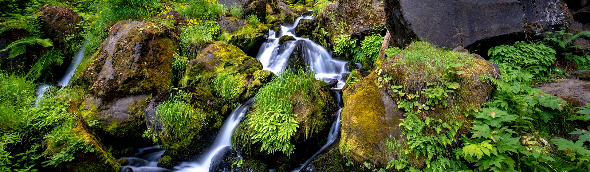
A sea of lush, green forest — home to 18 waterfalls and traversed by the meandering curves of the North Umpqua River — makes a breath-taking backdrop for a showcase of spring and summer wildflowers.
It’s also what makes Umpqua National Forest a perfect place to visit during those months. Unmatched for both its rugged landscape and pristine elegance, the Umpqua attracts outdoor enthusiasts from all over the globe.
For hikers, the forest’s centerpiece is the North Umpqua Trail, a 79-mile system that provides a picturesque path through the inspiring natural beauty of the Cascade Mountain Range. And all of this is just an easy 45-minute drive east of Roseburg along the National Scenic Byway of Oregon Highway 138.
The North Umpqua system consists of a dozen trailheads with each individual path ranging from 3.5 to 15.7 miles. This means both casual and serious hikers can find a suitable trail that combines colorful wildflowers with panoramic vistas.
Here’s just a few of the many trails and epic wildflower viewing areas along the National Scenic Byway of Highway 138. Grab your boots and camera and enjoy.
Mount Thielsen Trail provides a phenomenal vista for hikers ready for a strenuous climb. At 9,182 feet elevation, Thielsen is the highest point in the Umpqua National Forest. The trailhead is 1.5 miles north of the junction of highways 138 and 230, near Diamond Lake. The Thielsen trail intersects with the Pacific Crest Trail and proceeds to the summit. It is not an easy hike. The climb is gradual, then steepens sharply, especially near the summit. Hikers should exercise caution and should also bring their own drinking water as none is available along the trail.
The trail’s high elevation means wildflowers are best viewed during the summer. According to the U.S. Forest Service, August is typically the best month to view alpine wildflowers. Species include the Western pasqueflower (Anemone occidentalis), dirty socks (Eriogonum pyrolifolium), partridge flower (Luetkea pectinata), Newberry’s knotweed (Polygonum newberryi), and Jacob’s ladder (Polemonium pulcherrimum).
Pale, pink-flowered hybrids of rose mountain heather (Phyllodoce empetriformis) and white mountain heather (P. glanduliflora) might also be visible.
Toolbox Meadows is rubber-boots territory (and carrying Deet might also be a good idea).
This wetland, is breeding ground for a variety of plant species. The meadows are an arrangement of sedges (Carex spp.), Sitka alder (Alnus sitchensis), willow (Salix spp.), and Douglas spiraea (Spiraea douglasii).
Aquatic plants include common bladderwort (Utricularia macrorhiza), small burweed (Sparganium natans), and pondlily (Nuphar polysepalum). There’s also bog huckleberry (Vaccinium uliginosum), sticky tofieldia (Tofieldia glutinosa) and the insectivorous roundleaf sundew (Drosera rotundifolia).
Toolbox Meadow neighbors Lava Creek and Little Bear Lake. Go west on Highway 138 approximately 1.8 miles from the Lemolo Lake road (2610) junction. Turn north on Forest Service road 4780. Turn onto the 4780-800 road, which forks to the right immediately after turning onto the 4780 road. The road crosses Toolbox Meadow and Little Bear Lake after a little over a mile.
At Callahan Meadows, the hills are alive. This wide-open spot makes a great site for a spring or summer picnic amid colorful wild blooms. The meadows’ soil brings to life many unique flowers and plants. Among the visible flora are the Umpqua mariposa lily (Calochortus umpquaensis), Waldo rockcress (Arabis aculeolata), Hall’s violet (Viola hallii), cismontane minuartia (Minuartia cismontana) and clustered phacelia (Phacelia capitata). Visitors will also see Jeffery pine (Pinus jefferyi), incense cedar (Calocedrus decurrans), Indian pink (Silene hookeri), California poppy (Eschscholzia californica), slender and small-flowered godetia (Clarkia gracilis and C. quadrivulnera), and bluefield gilia (Gilia capitata).
From the Tiller Ranger Station, continue east on Highway 1 approximately three miles. Turn south across the bridge onto Forest Service Road 3230. Turn north on the 3230-300 road and right at the fork to the 320 spur. You will drive through a narrow band of trees into Callahan Meadow.
To download a North Umpqua Trails brochure, visit https://www.blm.gov/or/districts/roseburg/recreation/umpquatrails/planning_your_trek.html